REVISING THE MANUSCRIPT PART 3: Stuffing a Rag Doll

I never had a rag doll when I was a little girl; mine was the era of plastic Barbie and Ken. I’ve been thinking, though, that this round of editing is very much like stuffing a rag doll – say, one that is well-loved but getting a bit flabby.

I’m slicing into the manuscript and adding more detail in various parts. Some are at the heart of the story (road elevations, expanded detail about some of the settlements along the way) and some provide additional supporting information (steamboat lines).

Slice, open, stuff, close. My rag doll of a manuscript is fuller now, although maybe a little lumpy. “Editing Part 4” will involve a general review, to make sure the extra padding is all smoothed out and has resulted in a plumped-up, complete story.

Hmmm. Maybe this isn’t like a rag doll after all. Maybe it’s more like Botox Barbie!
REVISING THE MANUSCRIPT, Part 2

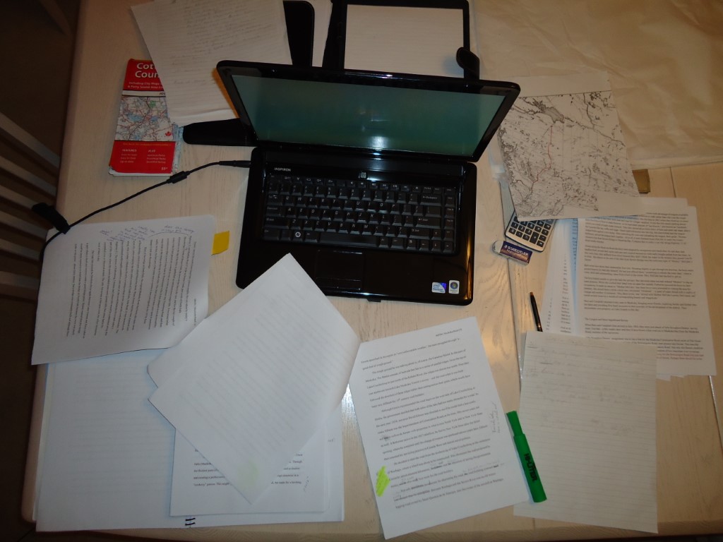
This is what revision looks like. It’s messy and it takes up a lot of room on my dining room table. Spread out over the work area you can see:

  • Five manuscript critiques, each one giving me suggestions for change, questions to clarify, corrections and more detail.
  • Maps, to help orient myself and provide accurate descriptions to my readers
  • Laptop for Internet access, to find yet more information in answer to the questions.

This is the Big Review. It resulted in a manuscript about 12,000 words longer than the first draft. You can see the new total in the word counter at the right-hand side of the blog.

I now move on to Final Review. This involves one more read-through of the entire manuscript. My cartographer Gary, who has been drawing the custom maps for the book, has double and triple-checked the route of the Muskoka Road using all his resources: topographical maps, aerial maps, Google maps. Rewrites will result! I’ll also be adding more detail about things like the Canadian Shield in Muskoka (almost a character in its own right), steamships, and the villages at the north end of the Muskoka Road. I’ll be double and triple-checking all the distances and dates I’ve cited in the book, and reviewing my  files to make sure I’ve included everything I have learned over the past year and a half of research.

At this stage as well, I’m putting together what is known as the “front matter” and “back matter” of the book: the preface, acknowledgements, dedication, bibliography.

And yes, there are still a few key illustrations I need to track down.

Am I sick of revision? No – and good thing too. Once it’s submitted to the publisher, the first thing that happens is a whole new round of editing.

SOME ASSEMBLY REQUIRED

I have over 70 photographs in my book plus six historical maps and 13 custom maps. For every illustration except the custom maps, I have to:

  • Find the source of the picture or map. Is it in a book? At the Archives of Ontario in Toronto? At Library and Archives Canada in Ottawa? In a library? At a museum? In a private collection? In my camera?
  • Find out if the picture or map is under copyright or in the public domain.
  • If it’s under copyright, find out who owns the copyright. Ask permission to reprint.
  • Regardless of whether the illustration is under copyright or in the public domain, note the proper way to reference the source – each organization or person requires something specific for this. Here’s an example from Archives of Ontario: RG15-13-3 Barcode F000932, File item RG-15-13-3-0-294-1.
  • Get an electronic copy of the picture in .tiff format, at least 300 dpi resolution for printing.
  • Store the picture in the proper folder on my computer, corresponding to the chapter it will appear in.
  • Write a caption for the picture and store it in a separate file, with a name corresponding to that of the illustration so they can be matched up later by the publisher. Include the proper source reference.
  • Keep track in a separate chart: the name of the illustration, the source, whether I have it or I am still chasing after it, whether I have permission to reprint in writing, and from whom.

70 photographs. Six historical maps. All form part of the submission to the publisher.

I feel like a new homeowner with a piece of furniture from Ikea and only an Allen key to help me.

REFLECTIONS FROM THE END OF THE ROAD

I’ve just returned from my final field trip hunting down the remains of the original Muskoka road. This time Geoff and I drove from just north of Burk’s Falls to Nipissing Village. And although I didn’t take as many pictures as I had wanted to – too many orange-clad men in pick-up trucks and gunshots in the woods – I still got a feel for the northernmost sections of the road. 

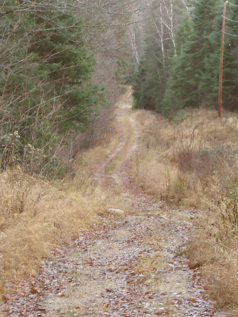
Nowhere else along the road’s length have I been so struck by how completely life changes. Here’s a picture taken at the intersection of the Muskoka Road and the South River Road.

South River Road from Muskoka Road looking east

This trail used to connect the village of Uplands – the northernmost settlement along the Muskoka Road – with South River, an important railway depot. Through South River on the train came the mail for all of Machar township, plus food and supplies for the five villages that once existed here.

There’s not much left of this formerly vital link. There’s not much left of Uplands either – no sign of the stores, the school, the post office. We saw maybe five modern houses and one woman walking an unruly dog. At one time this was the busiest settlement in Machar. But as the centre of commerce shifted to the east along the railway line, Uplands withered.

I was shocked to find that so little remains! I’ve been so immersed in the 1880s and 90s that I fully expected to see that once-major intersection of the Muskoka Road and the South River Road. Instead, we drove right by it and had to double back, peering into the woods until we saw the trail snaking off to the east.

So there you go: for everything there is a season. Some villages take root, thrive for a time, then slowly fade away. Some roads – including parts of the Muskoka – suffer the same fate, and are now mere traces on the map compared to former thick, vital lines.

 In fact, the ten northernmost kilometres of the Muskoka Road itself are now a snowmobile trail – best explored in winter and certainly not during hunting season.

RESEARCH A.K.A. DIGGING FOR BURIED TRUTH

Everything I’ve ever read about the Muskoka Road says that it got to North Bay in 1884. This information bothered me for two reasons. One, I couldn’t find the primary source to confirm it – a survey or newspaper report, or a map showing the route in 1884. Two, all the research I was doing about the North Bay area at that time – and about the towns to the south of North Bay that the road apparently went through on its way, towns like Powassan, South River, Trout Creek – said that these towns sprang up around railway depots, not a road.

But all these articles said the road got to North Bay in 1884.

You can guess where this is leading. I recently found the primary source material: annual reports from the Superintendent of Colonization Roads. I read them from 1880 to 1913. And the road went nowhere near North Bay. It terminated in Nipissing Village in 1898.

Who knew I was writing an exposé?

And what about these other articles? Where did this myth of North Bay in 1884 come from?

Here’s my theory. The accepted story of the Muskoka Road includes its evolution into the Ferguson Highway, which ran from Temagami to North Bay in 1927, and was quickly extended southward to encompass the supposed route of the Muskoka Road. I now know that the Ferguson between North Bay and roughly Sundridge encompassed trunk roads built by the government around 1900, not the Muskoka Road. This seems to have been forgotten over time. And as the Ferguson in turn evolved into today’s Highway 11, the details of the origin of the highway became less important and the misinformation kept getting repeated in later reports.

I am very glad that I dug deeper and did not continue to perpetrate the myth. Stay tuned for the next episode of CSI Muskoka!

APPROACHING THE MANUSCRIPT REVISION

In Holly Lisle’s Boot Camp for Writers called “How to Think Sideways,” she teaches how to revise the first draft of a novel. You need to have a plan, she says, and you need to revise only once. Her process includes stepping back to ask yourself some big-picture questions before starting to edit.

While I won’t follow her approach exactly with Main Street – for one reason, my book is not a novel – I do see the value of asking Holly’s big-picture questions before I dive into the revision process.

So here goes:

1. Write one sentence that describes what you want this book to be.

This is the story of the Muskoka Colonization Road, told through the eyes of the people who designed, built and travelled it for the past 150 years.

2. Why did you write this book?

I wrote it because I was invited to by a publisher who read an article I wrote about the Muskoka Road. This opportunity is the stuff that writers dream of!

3. What do you want your readers to find in your story?

I want my readers to find a historical adventure story filled with courageous and creative characters… and a spectacularly beautiful region of Ontario that refused to be tamed.

4. How did writing this story change you and what do you hope to leave with your readers?

I learned so much more than I had expected – way beyond the boundaries of Muskoka-Parry Sound. I took on new challenges as a writer. I developed a much stronger pride in the rich history of my home province. I also no longer take roads for granted!

I hope to leave my readers with a rollicking good story, some new information and a better sense of what it took to build Ontario.

Now, somebody hand me a red pen – let the edits begin!