THE MUSKOKA COLONIZATION ROAD: Tree Stumps and Ridges and Dirt, Oh My!
When we drive almost anywhere in the world today, we do so expecting good roads. Paved roads, ones that have been engineered for safety, with curves that are easy to negotiate. We are affronted by pot-holes and cracks in the asphalt. We expect that obstacles like rivers, undeveloped land or rock ridges are removed or bridged so we can get to where we are going as quickly and easily as possible. Roads for the most part are straight, level and paved.
Until the 1930s, The Muskoka Colonization Road was anything but. Rivers and lakes, when they couldn’t be avoided, were crossed by simple wooden bridges that tended to sway alarmingly and get washed out in spring floods. Settlers hacked the road out of very dense forest, chopping down trees where the surveyors’ chains marked the route. They left the tree stumps to rot, which made for a pockmarked obstacle course that was often easier for people to walk through than for horses to pull a wagon through. There was no engineering at the time that could cut through a granite ridge, so the road went over or around these – often, since granite ridges are as plentiful as mosquitoes in Muskoka.
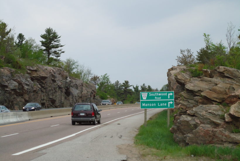
Here’s a view of Highway 11 just north of the Severn Bridge, heading north.

See how the rock-cut makes the road nice and flat for the cars? When you’re speeding along this stretch of the highway, almost at the cottage, I bet you don’t even notice the rock-cut. Which is too bad, because it’s gorgeous. But it’s also a feat of engineering that would stun the average Muskoka pioneer. That poor person had to haul all his belongings up the ridge and down the other side. At this exact spot – the southern boundary of the Muskoka District and near the official start of the Muskoka Road – the ridge is over 15 metres high.
No wonder hundreds of potential settlers took one look and turned around!
