|

THE PAST IS NEVER FAR AWAY

On a stretch of the Old Muskoka Road just north of Utterson, a few pieces of corduroy have heaved their way to the surface. “Corduroy” refers to the logs set cross-ways on a pioneer road, usually in the more boggy sections. Certainly the area between Utterson and Allensville is particularly low, so it makes sense there would have been a need for corduroy here.
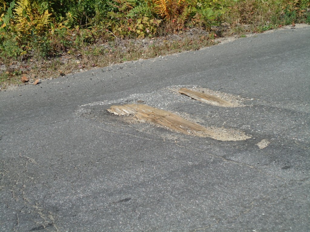
I’m always thrilled to step on an actual piece of the road trod by many of the people I wrote about: Harriet King, Florence Kinton and others travelled this section of the road.

Last weekend, I listened with a smile as the people who live on the road today warned visitors that the road is twisty, full of potholes and dangerous cracks and needs to be travelled carefully. In fact, some helpful neighbours have drawn squiggly yellow lines on top of the worst humps and written CAUTION with arrows in several spots to warn drivers. I’m sure if the stagecoach drivers of the 1800s could have scrawled something in the dirt path to warn others of the perils of the road, they would have. As I’ve said many times when summing up the story of this road: “the road was awful; it was always awful; the end.” And so history continues in a modern form!

In Torrence, the Muskoka Conservancy owns a protected tract of land where an old growth pine tree stands. Botanists estimate it’s about 150 years old. So when the Muskoka Road was just being hacked out at its starting point a few kilometers to the southeast in Washago, this tree was the mere sprout of an acorn. It somehow survived the 19th century logging as well as a widespread fire in the 1930s to grow to a girth of 1.2 metres (almost four feet) at its base and a height of easily 15 metres (50 feet.) I gazed up into the canopy and tried to imagine a tree twice that girth and 25 metres – 82 feet – tall. That’s what Muskoka’s original old growth forests held when the first pioneers arrived… with their hand axes for tree chopping.

I love when the past shows glimpses of itself! These log pieces and this massive pine remind me that we are never far from our pasts… as individuals or as districts.

WALKING THE MUSKOKA ROAD TODAY

It’s one thing to drive along part of Highway 11 and know you’re following the same route as the original Muskoka Colonization Road. It’s quite another to walk along part of the original road that still looks like it did 150 years ago.

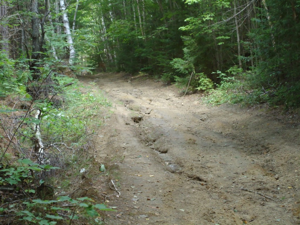
This is the Muskoka Road as it looked back in the 1800s: a dirt pathway that gambols up and down and around and through some of the roughest territory in Muskoka-Parry Sound. This is the actual road just north of Huntsville:

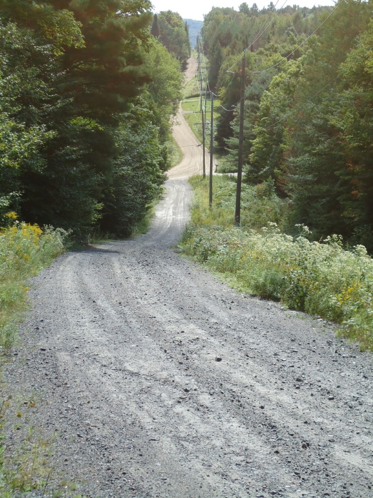
Complete with ruts, minus the tree stumps, and maybe four feet narrower than in the 19th century, stretches of the original road can still be travelled, if not by car, then by foot or mountain bike. Picture yourself clinging to the side of the stagecoach along this stretch just north of the Big East River:

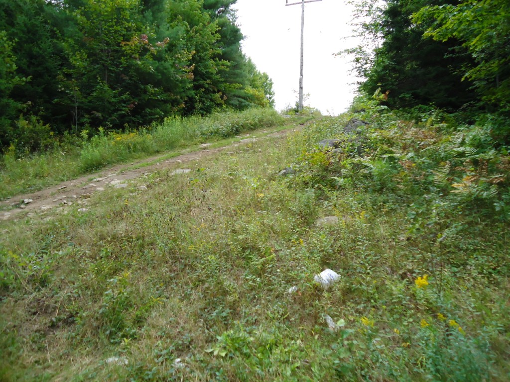
Remember that the road was maintained by the adjoining settlers under statute labour laws, which required every man over the age of 18 to provide two days of road work per year. But every man over the age of 18 was too busy trying to hack a farm out of his “free grant land” to do much road maintenance. Here’s part of James Matice’s 100 acres, which rises up along the east side of the Muskoka Road at the very north end of Chaffey Township:

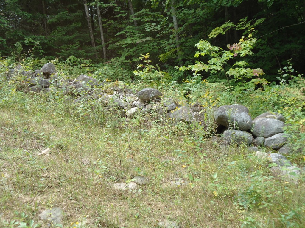
In 1879, Matice and his wife Mary lived with their eight children in a shanty or log house right beside the road near this stone fence:

A little over a decade later the 1891 census shows no trace of the Matice family anywhere in Canada. I wonder why. Or is it obvious from the look of their land?

I plan to walk more sections of the original road – as much as is possible all the way to North Bay. But my adventure doesn’t begin to match that of the surveyors, settlers and entrepreneurs who made their way along this exact route 150 years ago.

MORE FUN FACTS ABOUT ONTARIO ROADS

Here’s more from Footpaths to Freeways: The Story of Ontario’s Roads, published by the Ontario Ministry of Transportation and Communications in 1984. Who knew the history of roads could be so interesting? For more on this fascinating topic, you’ll just have to wait for my book on the Muskoka Colonization Road!

Car licences have been issued in Ontario since 1903. The earliest were leather tags; licence plates came about in 1925.

The first highway patrol officer was appointed in 1907. Until 1946, motorcycle patrol officers had to buy their own motorcycles.

Chauffeurs had to have drivers’ licences starting in 1909; licences became compulsory for all Ontario drivers in 1927. At first there was no driver’s test; you just filled out an application form.

By 1914 traffic jams were a constant problem along Lake Shore Road between Toronto and Hamilton.

Ontario’s first hard-surfaced highway, between Toronto and Hamilton, was paved in cement and completed in 1917. It was built to help deal with the traffic jams on Lake Shore Road and at the time, it was one of the longest hard-surfaced highways in the world.

The first gasoline tax came into effect in 1925, to help pay for highway improvements.

Ontario’s first set of traffic lights was installed in Hamilton in July 1925 at the intersection of King and Main Streets.

When it opened in 1939, the Queen Elizabeth Way in the Niagara region was the longest continuous divided highway in Canada.

Highway 400 is the second-longest freeway in Ontario (401 is the longest.) The 400 stretches from Toronto through Barrie to Parry Sound and will end up in Sudbury in about 2017. The portion of the highway between Toronto and Lake Simcoe roughly follows the route of the historic “Toronto Carrying-Place Trail” a major portage route linking Lake Ontario with Lake Simcoe and the northern Great Lakes. The trail was widely used over three hundred years ago by First Nations people and fur traders.

Fun Facts About Ontario Roads: 1700 to 1903

I bet you didn’t know there are fun facts about Ontario roads! Neither did I, until I started researching the Muskoka Colonization Road. Here is some of what I learned from a book called Footpaths to Freeways: The Story of Ontario’s Roads, published in 1984 by the Ontario Ministry of Transportation and Communications. More to come in a later post. Enjoy!

Ontario’s first “roads” were actually its rivers and lakes, linked where necessary by portages (meaning “carrying place”) and used by natives and fur traders for hundreds of years.

Most roads in Ontario were dirt until well into the 20th century.

“Corduroy Roads” were made by laying logs across over dirt roads and were used to cross swamps and bogs. A big improvement to dirt and corduroy roads were “macadamized” (gravelled) roads, used from the mid-1830s. Another innovation from about the same time was planked roads, which cost about ¼ that of gravel roads. Lumber was cheap and readily available, but plank roads got torn up by horses’ hooves and had to be replaced more often.

“Statute labour” was introduced by the government in 1793, compelling landowners to provide up to 12 days’ labour a year for road and bridge construction, based on the assessed value of their property. This law has still not been repealed by the Ontario government, so is still in effect in any township that has not formally abolished it.

The original purpose of Yonge Street in Toronto was as a military road leading north, opening a route to the upper Great Lakes. As of August 1794 Yonge Street had been partly “opened” (cut out of the bush) but construction stopped because of the threat of American attack and the need to take the soldiers who were building the road to the Niagara Frontier.

Toll roads have been in use in Ontario since 1825.

In 1896, A.W. Campbell, Ontario’s Instructor in Road-Making stated in his report: “By far the greatest part of the mileage of the province is mud, ruts and pitch-holes.”

The first car owner in Canada was John Moodie of Hamilton. In 1898, he bought a single cylinder, gasoline-powered “runabout” manufactured by the Winton Motor Carriage Company of Cleveland.

Early automobiles were known by their detractors as “devil’s carts” “stink wagons” and “juggernauts of the streets”.

High-performance cars of 1902 could travel at a staggering 20 miles per hour [32 kph], prompting a maximum speed limit of 15 mph [24 kph] to be established in 1903. Early speed traps included two constables placed one-tenth of a mile apart, to clock each passing car using a stopwatch. To stop a speeding car, the police simply threw a plank studded with nails into the path of an oncoming motorist. If the driver could stop before reaching the plank, he was driving within the speed limit and was free to go. If not – hopefully he had a spare tire.

THE MUSKOKA COLONIZATION ROAD: Tree Stumps and Ridges and Dirt, Oh My!

When we drive almost anywhere in the world today, we do so expecting good roads. Paved roads, ones that have been engineered for safety, with curves that are easy to negotiate. We are affronted by pot-holes and cracks in the asphalt. We expect that obstacles like rivers, undeveloped land or rock ridges are removed or bridged so we can get to where we are going as quickly and easily as possible.  Roads for the most part are straight, level and paved.

Until the 1930s, The Muskoka Colonization Road was anything but. Rivers and lakes, when they couldn’t be avoided, were crossed by simple wooden bridges that tended to sway alarmingly and get washed out in spring floods. Settlers hacked the road out of very dense forest, chopping down trees where the surveyors’ chains marked the route. They left the tree stumps to rot, which made for a pockmarked obstacle course that was often easier for people to walk through than for horses to pull a wagon through. There was no engineering at the time that could cut through a granite ridge, so the road went over or around these – often, since granite ridges are as plentiful as mosquitoes in Muskoka.

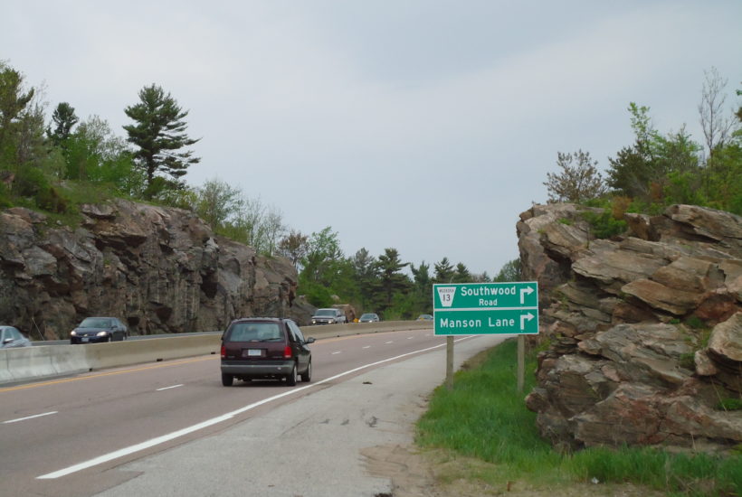
Here’s a view of Highway 11 just north of the Severn Bridge, heading north.

See how the rock-cut makes the road nice and flat for the cars? When you’re speeding along this stretch of the highway, almost at the cottage, I bet you don’t even notice the rock-cut. Which is too bad, because it’s gorgeous. But it’s also a feat of engineering that would stun the average Muskoka pioneer. That poor person had to haul all his belongings up the ridge and down the other side. At this exact spot – the southern boundary of the Muskoka District and near the official start of the Muskoka Road – the ridge is over 15 metres high.

No wonder hundreds of potential settlers took one look and turned around!